

Summary
- What is it? A thematic cultural corridor synthesizing the Artuqid beylik architecture (Hasankeyf, Harput, and Mardin branches) of stone, water, and defensive structures from the 12th–13th centuries [1], [2], [3].
- Route: A ~210 km path starting within Diyarbakır Walls in the Tigris basin, traversing Silvan Valley (Batman River), crossing Tur Abdin to Mardin’s terraced views of Mesopotamia [1], [2], [4].
- Key Structures: Diyarbakır Fortress and Walls (Hevsel Gardens axis), Malabadi Bridge, Mardin Ulu Mosque and Kasımiye Medrese [1], [2], [3], [4].
- Recommended Duration: 2 days (Day 1: Diyarbakır Walls and Silvan Malabadi Bridge; Day 2: Mardin Old City fabric, Ulu Mosque, and Kasımiye Medrese) [1], [2], [4].
Dicle Basin and Artuqid Cultural Geography
Upper Mesopotamia forms the northern boundary of the fertile alluvial plain irrigated by the Tigris River and its tributaries descending from Anatolian highlands [1]. Following Seljuk conquests in the late 11th century, the sons of Artuq Bey (Sökmen and İlgazi) established a multi-layered architectural school spanning nearly three centuries in this region [1], [2]. The Artuqids synthesized ancient Roman-Byzantine defensive infrastructure, Islamic spatial philosophy, and Tigris hydraulic engineering into a singular architectural tradition [1], [2].
This corridor functions as a historical bridge between two contrasting geological realms [1], [3]:
- One end features Diyarbakır’s fortified city, sculpted from the hard, porous black basalt erupted by Karacadağ volcano [1].
- The other end rises in Mardin, where soft limestone (Mardin stone) is intricately carved into terraced settlements that glow amber at dawn and crimson at dusk [3], [4].
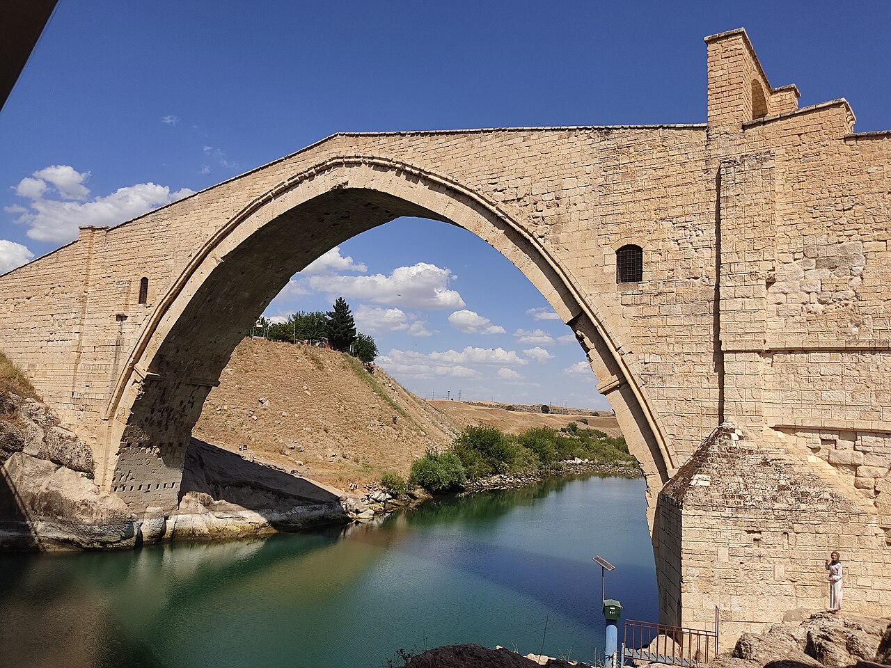
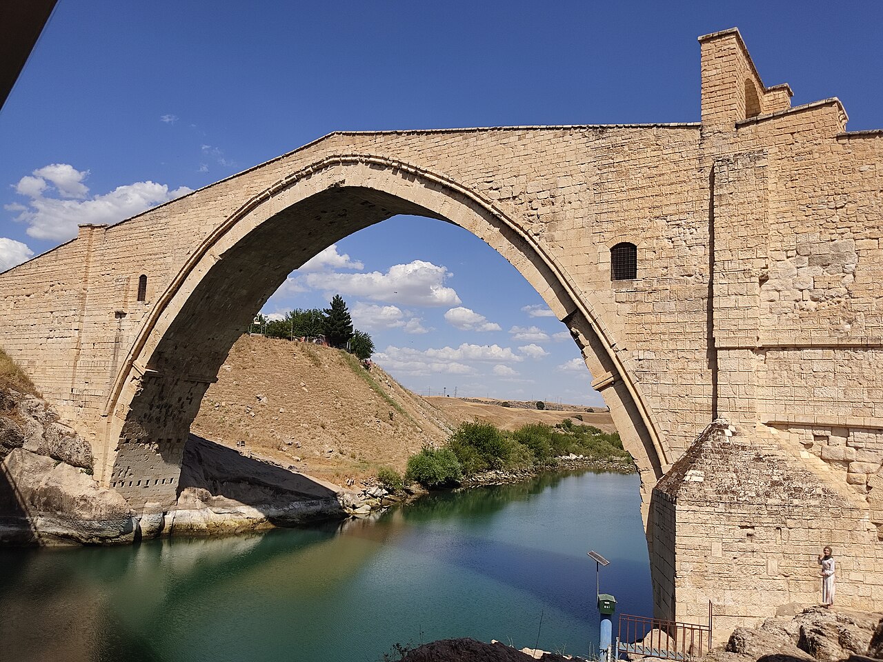
Central to this corridor is the Malabadi Bridge, a medieval engineering marvel spanning Batman River with a single massive pointed arch. This structure, completed by Artuqid Emir Timurtaş in 1147, achieved an unprecedented span of 38.60 meters—comparable to the dome of Hagia Sophia [2]. Beyond its structural ingenuity, the bridge served as a protected caravanserai with sheltered rooms, helical staircases, and watchtowers for travelers navigating winter storms [2]. Human, sun, and lion reliefs on the arch piers reflect Artuqid astrological symbolism [2].
The Artuqids transformed this arid landscape into a civilizational hub through monumental infrastructure: defensive walls, flood-resistant bridges, medrese complexes with hydraulic fountains as metaphysical contemplation spaces, and grand mosques overlooking Mesopotamian plains [1], [2], [3], [4].
Route Stops and Monumental Architecture
The structures along this route exemplify four apexes of Artuqid architectural and engineering genius [1], [2], [3], [4]:
1. Stop: Diyarbakır Fortress and Walls (Armor of Black Stone)
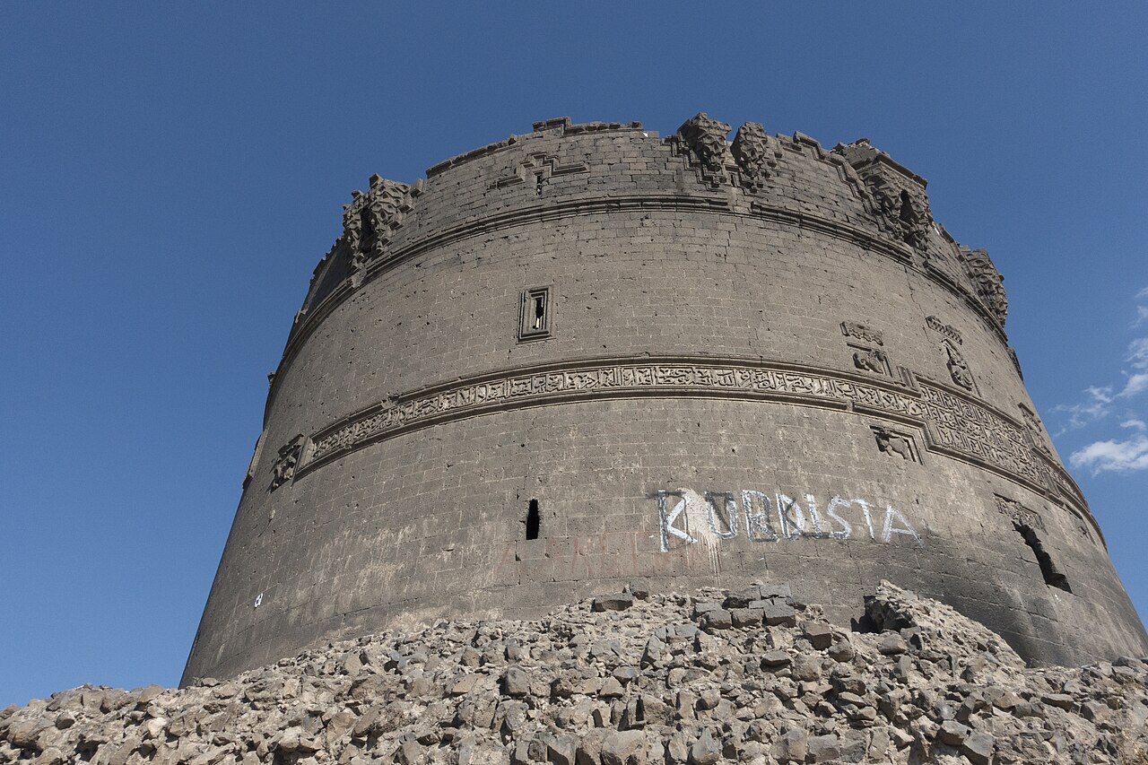
UNESCO World Heritage-listed Diyarbakır Walls, stretching 5,200 meters with 82 towers, constitute one of the world’s most robust defensive systems [1]. Built on Roman foundations, they were transformed into an open-air museum by Artuqid ruler Melik Salih Mahmud and architect Ca’fer b. Mahmûd in the 13th century [1]. Twin-headed eagles, winged lions, and Kufic epigraphic bands on towers like Ulu Beden (Evli Beden) and Yedi Kardeşler demonstrate the pinnacle of stone-carving plasticity. The Hevsel Gardens at the base of the walls complete a millennia-old synthesis of defense and agriculture [1].
2. Stop: Malabadi Bridge (Apex of Stone Arches)
Completed in 1147 by Artuqid Emir Timurtaş, this bridge spans 38.60 meters with an unprecedented pointed arch—capable of enclosing the dome of Hagia Sophia [2]. Beyond its structural grandeur, it functioned as a protected caravanserai with sheltered rooms, helical staircases, and watchtowers for travelers navigating winter storms [2]. Human, sun, and lion reliefs on the arch piers reflect Artuqid astrological symbolism [2].
3. Stop: Mardin Ulu Mosque (Transverse Space and Segmental Dome)
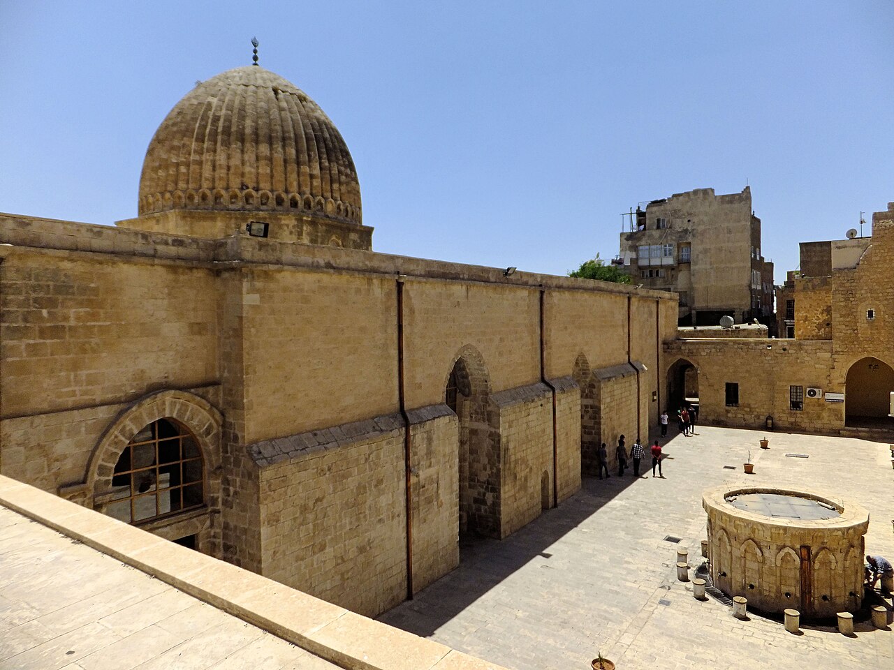
Mardin Ulu Mosque (1176), situated on the southern slope of Mardin Fortress overlooking the plain, epitomizes Artuqid mosque architecture [3]. Its transverse three-nave plan, monumental dome with trompe passage intersecting two naves at the mihrab, and externally articulated segmental dome ribs created a regional domed architectural school [3]. The courtyard’s hydraulic iwan and 19th-century restored chessboard Kufic minaret define Mardin’s silhouette [3].
4. Stop: Kasımiye Medrese (Stone Fountain and Life Cycle)
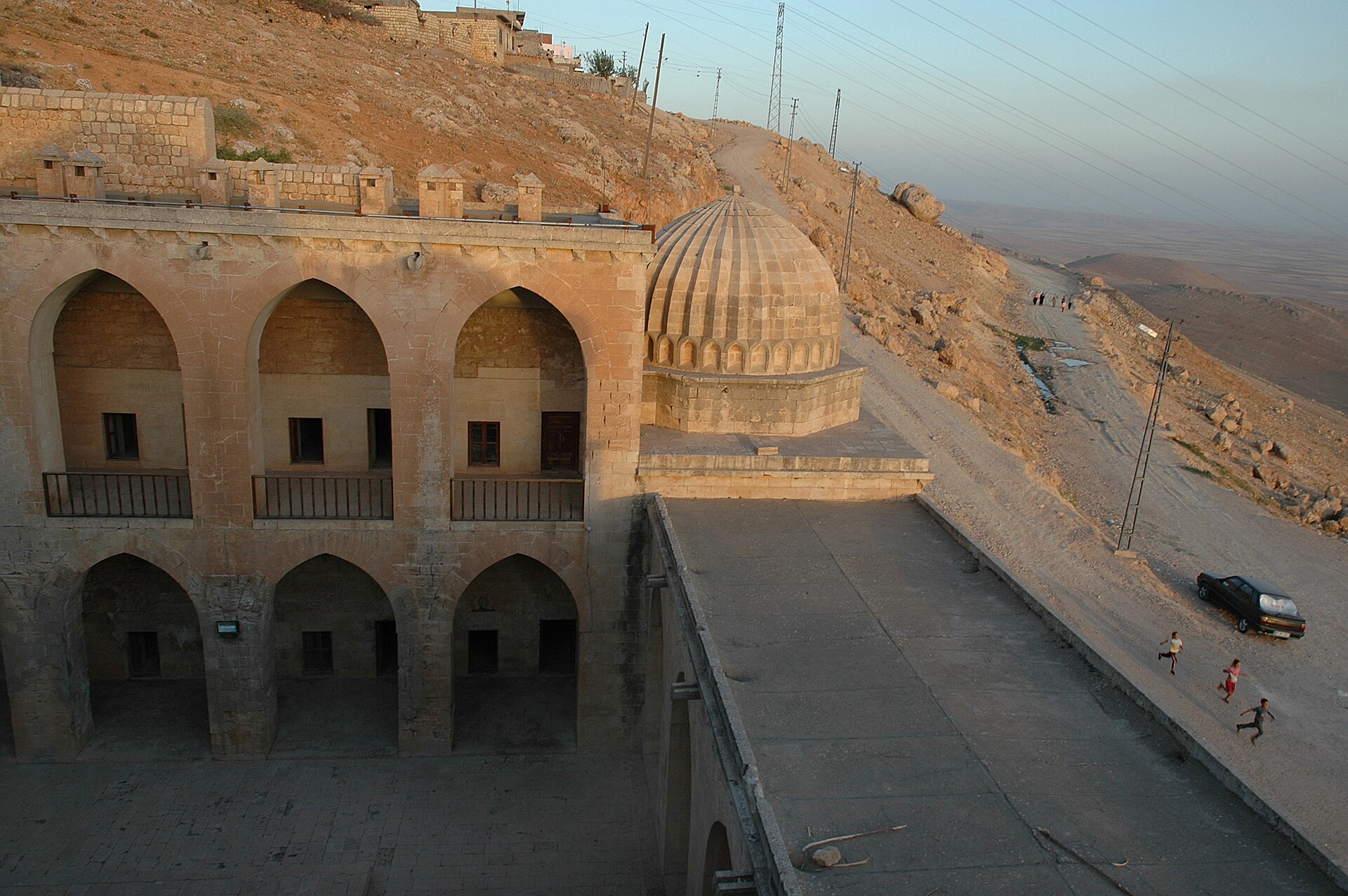
Located on the southwestern outskirts of Mardin, overlooking Mesopotamia, Kasımiye Medrese was initiated by Artuqids and completed in the late 15th century by Akkoyunlu Sultan Kasım Bey [4]. Its two-story, open courtyard plan features a philosophical hydraulic system: water flowing from the northern iwan through a fountain into a pool symbolizes human birth, youth, old age, and resurrection [4]. The attached segmental-domed tomb and mosque unite education with spirituality under a single canopy [4].
Two-Day Itinerary and Logistics
A 2-day itinerary is recommended to traverse this route according to geographical sequence and light conditions [1], [2], [4]:
-
Day 1 (Diyarbakır–Silvan–Batman Route / 95 km):
- Morning: Explore Diyarbakır’s Inner Fortress and Old City. Walk from Dağ Kapı to Urfa Kapı, examining Artuqid reliefs on Ulu Beden and Yedi Kardeşler towers; view Hevsel Gardens from Keçi Burcu [1].
- Afternoon: Travel east via D360 highway toward Silvan. Cross Silvan Valley to Malabadi Bridge. Photograph the bridge’s monumental arch span from riverbanks and access tunnels [2].
- Evening: Proceed through ancient passes to Mardin (approx. 110 km drive), staying in traditional stone houses.
-
Day 2 (Mardin Old City and Mesopotamia / Urban Walk):
- Morning: Visit Mardin Ulu Mosque. Study its transverse nave plan, segmental dome, and courtyard stonework [3]. Explore the old city’s fabric through abbar (narrow alleys) in the marketplace.
- Afternoon: Descend to Kasımiye Medrese on the southern slope. Contemplate the courtyard’s hydraulic philosophy; view Mesopotamian plains from terraces [4].
- Sunset: Observe sunset from Mardin’s old city terraces, concluding the route.
Harita
Harita: © OpenStreetMap katkıcıları. Bu yazıda anılan bazı yapılar ve kendi yazıları:
Visit Notes
- Transportation: The Diyarbakır–Silvan–Mardin route is accessible via divided national roads. Comfortable walking shoes are essential for navigating Mardin’s steep abbar alleys.
- Climate: Summer temperatures exceed 40°C; ideal visiting seasons are April-May and October-November.
- Access Conditions: Mosques are open during prayer hours; current regulations for walls, bridges, and medreses should be checked via the Ministry of Culture and Tourism.
October 2026
References
- [1] “DİYARBAKIR” (Fortress and Walls) — TDV İslâm Ansiklopedisi, Vol. 9 (Prof. Dr. Abdüsselâm Uluçam & Prof. Dr. Şevki Nezihi Aykut) — https://islamansiklopedisi.org.tr/diyarbakir
- [2] “MALABADİ KÖPRÜSÜ” — TDV İslâm Ansiklopedisi, Vol. 27 (Prof. Dr. Abdüsselâm Uluçam) — https://islamansiklopedisi.org.tr/malabadi-koprusu
- [3] “MARDİN ULU CAMİİ” — TDV İslâm Ansiklopedisi, Vol. 42 (Prof. Dr. Ara Altun) — https://islamansiklopedisi.org.tr/mardin-ulu-camii
- [4] “KĀSIMİYE MEDRESESİ” — TDV İslâm Ansiklopedisi, Vol. 24 (Prof. Dr. Abdüsselâm Uluçam) — https://islamansiklopedisi.org.tr/kasimiye-medresesi
Stops along the Route (4)

This article is compiled from scholarly monographs and official architectural inventories. Please verify site access conditions, visiting hours, and ongoing conservation status via official heritage authorities prior to visiting.