
October 2026
Overview
- What: Fairy chimneys sculpted by the erosion of volcanic tuff, alongside rock-hewn monasteries, churches, and subterranean sanctuaries [1].
- Where: In Turkey’s Central Anatolia Region, situated across a historic landscape centered primarily in Nevşehir and extending into neighboring Central Anatolian provinces [1].
- Why it matters: It served as an intellectual center of early Christianity and was inscribed onto the UNESCO World Heritage List in 1985 [1].
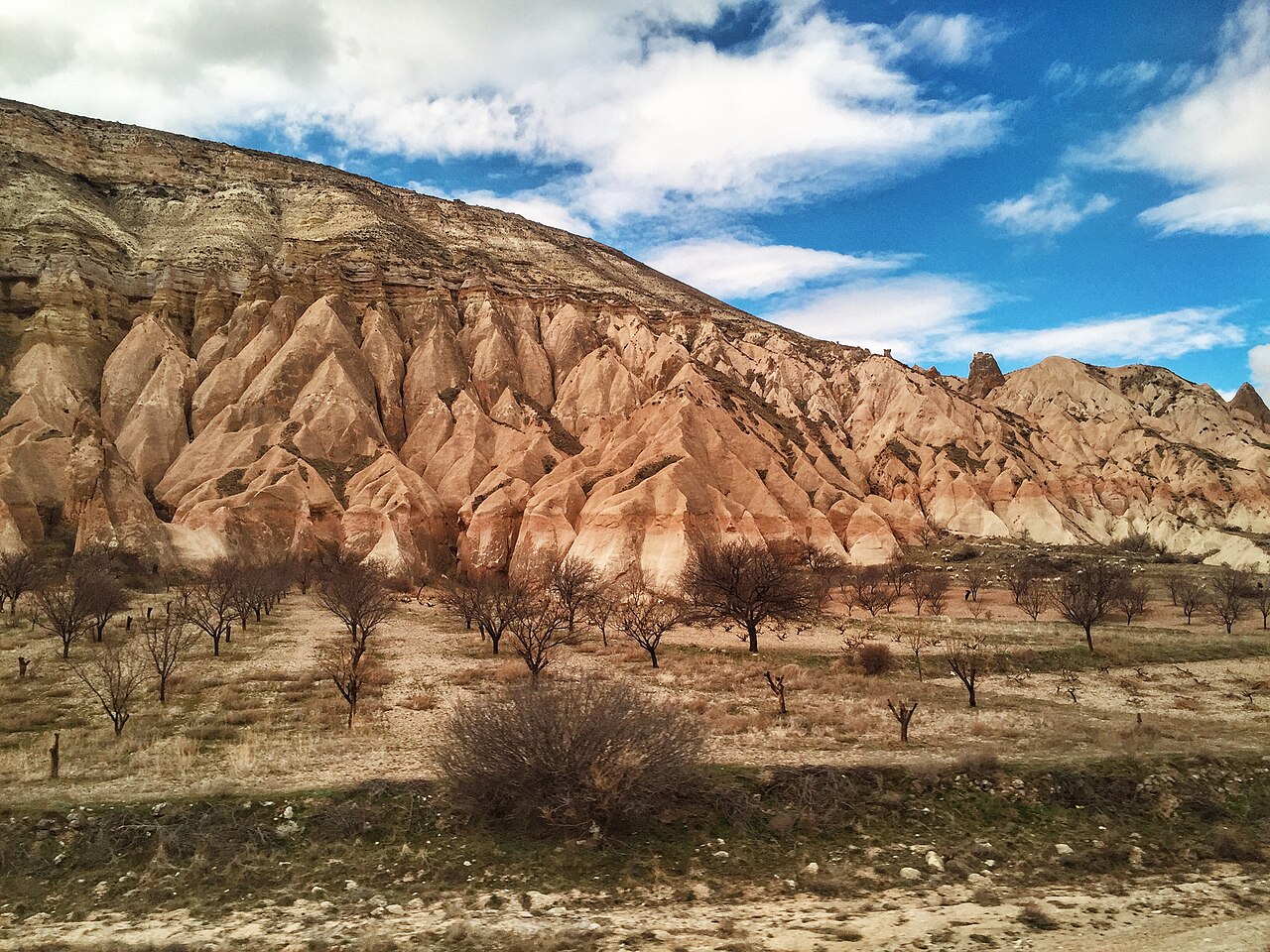
Göreme Historical National Park is the joint product of millions of years of volcanic activity and human labor [1]. The tuff layers in the region attained their present form through the wind erosion of lava and ash originating from Mount Erciyes, Mount Hasan, and Göllüdağ [1]. Tuff is a porous, soft rock type formed over time as ash and lava fragments ejected by volcanoes compress and petrify [1]. According to sources, this unique natural setting provided highly secure living spaces for communities seeking refuge in the past [1].
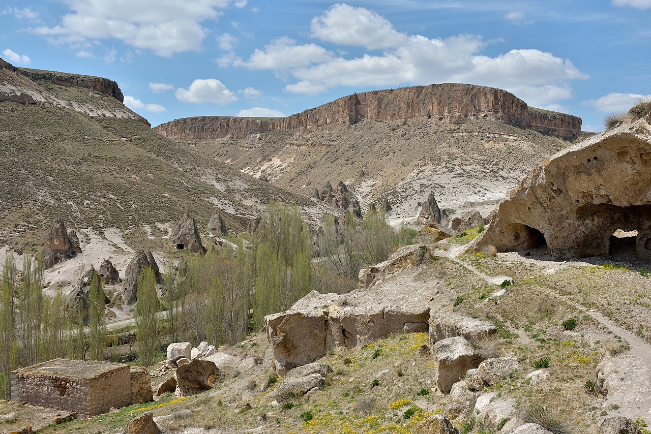
Carved into the soft volcanic rocks, these structures have carried traces of millennia of civilizations down to the present day [1]. Spanning the valley slopes, the settlements demonstrate a rare integration of natural phenomena and human habitation [1]. Beyond its natural wonder of fairy chimneys, Göreme and its surroundings are recognized internationally for their profound religious heritage [2]. Fairy chimneys are tower- or cone-shaped natural landforms that emerge when harder capping rocks protect the underlying softer tuff layers from erosion [1].
This historical landscape has served as an important crossroads hosting numerous cultures over the centuries [1]. Linked to trade routes throughout history, the region uninterruptedly transmits the religious and artistic world of the past to the modern day [1].
Where is it?
Administratively, the Cappadocia region today lies within the borders of Nevşehir, Kayseri, Aksaray, Kırşehir, Sivas, and Niğde provinces [1]. However, touristic Cappadocia and the densest concentration of geographic formations are gathered across an area of approximately 250 square kilometers centered on the provincial boundaries of Nevşehir [1]. The geographic coordinates of the site are 38 degrees 37 minutes 06 seconds north and 34 degrees 52 minutes 02 seconds east [1]. Geographic coordinates represent the precise numerical address indicating a point’s location on the Earth’s surface relative to lines of latitude and longitude [1]. Here, the northern coordinate precisely indicates the site’s distance from the Equator, while the eastern coordinate marks its position relative to the Prime Meridian on a map [1].
The boundaries of the region have been described in various ways by different authors throughout history [1]. The ancient historian Herodotus recorded that during the Ionian Revolt of 499 BC, the Cappadocians extended from the Taurus Mountains to the Black Sea coast [2]. By this definition, the territory was bounded on the south by the Cilician mountains [2]. To the east it was bordered by the Euphrates River, to the north by Pontus, and to the west by the regions of Lycaonia and Galatia [2].
Strabo, a geographer living during the reign of the Roman Emperor Augustus, outlined a similar framework in his work Geographica [1]. According to Strabo, the region spanned between the Taurus Mountains to the south, Aksaray to the west, Malatya to the east, and the Black Sea to the north [1]. Today, the most visited localities are Ortahisar, Uçhisar, Göreme, Avanos, Ürgüp, Derinkuyu, Kaymaklı, and the environs of Ihlara [1].
Göreme National Park and the Rock Sites of Cappadocia were inscribed onto the UNESCO World Heritage List in 1985 under reference number 357 [2]. The World Heritage site encompasses a vast surface area totaling 9,883.81 hectares, or approximately 24,423.4 acres [2]. This extensive protected area encompasses Göreme National Park, the Kaymaklı Underground City, and the Derinkuyu Underground City [2].
History & Origins
The name of the region first appears as Katpatuka in Persian sources dating to the 6th century BC [1]. Scholars hold differing views regarding the precise origin of this name [1]. Some experts have suggested that the word translates to “Low Country” in the Luwian language [1]. However, linguistic studies have revealed that the adverb katta, meaning “below” or “down,” belongs to the Hittite language [1]. The same research indicates that the equivalent term in Luwian is zanta [1].
There is evidence that the widely circulated Persian designation “Land of Beautiful Horses” does not reflect historical reality [1]. Photographer Ozan Sağdıç disclosed that he personally coined this epithet during the September 12 military regime to prevent a ban on the name Cappadocia [1]. Furthermore, it is noted that the authentic word signifying the land of good horses in Persian is Huv-aspa [1].
Human settlements in the region trace back to the Paleolithic, or Old Stone Age, period [1]. The Paleolithic is the earliest prehistoric era, during which humankind fashioned its first stone implements [1]. The recorded history of Cappadocia, however, began with the Hittites, who established trade centers and marketplaces across the territory [1]. The collapse of the Hittite Empire occurred in the 12th century BC [1]. Following this collapse, Late Hittite Kingdoms bearing Assyrian and Phrygian influences assumed governance [1]. The rule of these kingdoms continued uninterrupted until the Persian invasion in the 6th century BC [1].
Alexander the Great defeated the Persians in 332 BC [1]. Nevertheless, Alexander encountered fierce local resistance in the Cappadocia region [1]. During this era, an independent Kingdom of Cappadocia was established, ruling over the territory for an extended period [1]. From the late 3rd century BC onward, the military and political influence of the Roman Empire was increasingly felt across the land [1].
By the mid-1st century BC, Cappadocian kings were no longer able to act independently [1]. Monarchs began to be installed and deposed on the decisions of Roman generals [1]. In 17 AD, the final king of Cappadocia passed away [1]. Thereupon, the region was officially organized into a Roman province [1]. Christian communities that settled here in the 3rd century AD transformed the area into a prominent center of faith and thought [1].
The severe persecution mounted by the Roman administration between 303 and 308 intensified the Christians’ search for safe havens [1]. The deep valleys of Cappadocia afforded shelter to refugees [1]. Concurrently, the easily carved volcanic rock created secure environments for those seeking to freely practice and disseminate their faith [1]. Throughout the 4th century, prominent theologians known as the “Cappadocian Fathers” guided intellectual and spiritual life across the region [1].
In 726, Byzantine Emperor Leo III banned religious images and icons [1]. This prohibition once again brought the region’s sanctuary character to the fore [1]. During the period of Iconoclasm—the destruction of religious images that lasted for more than a century—numerous people who defended the veneration of sacred icons took refuge in the valleys of Cappadocia [1]. Iconoclasm was a turbulent era during which religious symbols and depictions were removed or destroyed across sanctuaries [1]. Although several local churches were affected by the bans during this process, monasteries nevertheless maintained their development, and worship could be conducted freely within them [1].
During the same era, Arab incursions directed against Christian defense lines extending from Armenia to Cappadocia commenced [1]. Diverse communities fleeing these raids and sheltering in the region joined monastic life [1]. Over time, these new groups prompted stylistic transformations in the architecture of the local churches [1]. In the 11th and 12th centuries, the region passed under the dominion of the Seljuk Dynasty [1]. It subsequently experienced a peaceful and untroubled period during the Ottoman era [1]. The last remaining Christian communities departed the region during the population exchange of 1924–1926 [1].
Architectural Form
Geologically, the Cappadocian territory lies within the Central Anatolian Volcanic Belt [1]. Approximately 60 million years ago, Mount Erciyes, Mount Hasan, and Göllüdağ erupted lava as active volcanoes [1]. These volcanic lavas spread across a vast expanse [1]. Dense ash discharges resulting from the eruptions also accumulated over time [1]. These accumulations laid the groundwork for soft tuff strata of varying thicknesses to form throughout the region [1].
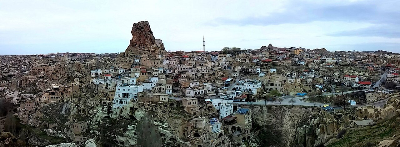
The localities of Ortahisar and Uçhisar represent the sites of the densest accumulation of pyroclastic materials [1]. The term pyroclastic material designates all volcanic solid matter hurled into the surrounding environment during volcanic eruptions, such as lava fragments, ash, scoria, and solidified stone blocks [1]. Owing to wind direction and topography, lava accumulation along this alignment proved significantly thicker than in other sectors [1]. Thanks to these deep tuff strata, monumental monolithic rock masses such as the citadels of Ortahisar and Uçhisar have survived erosion to reach the present day [1].
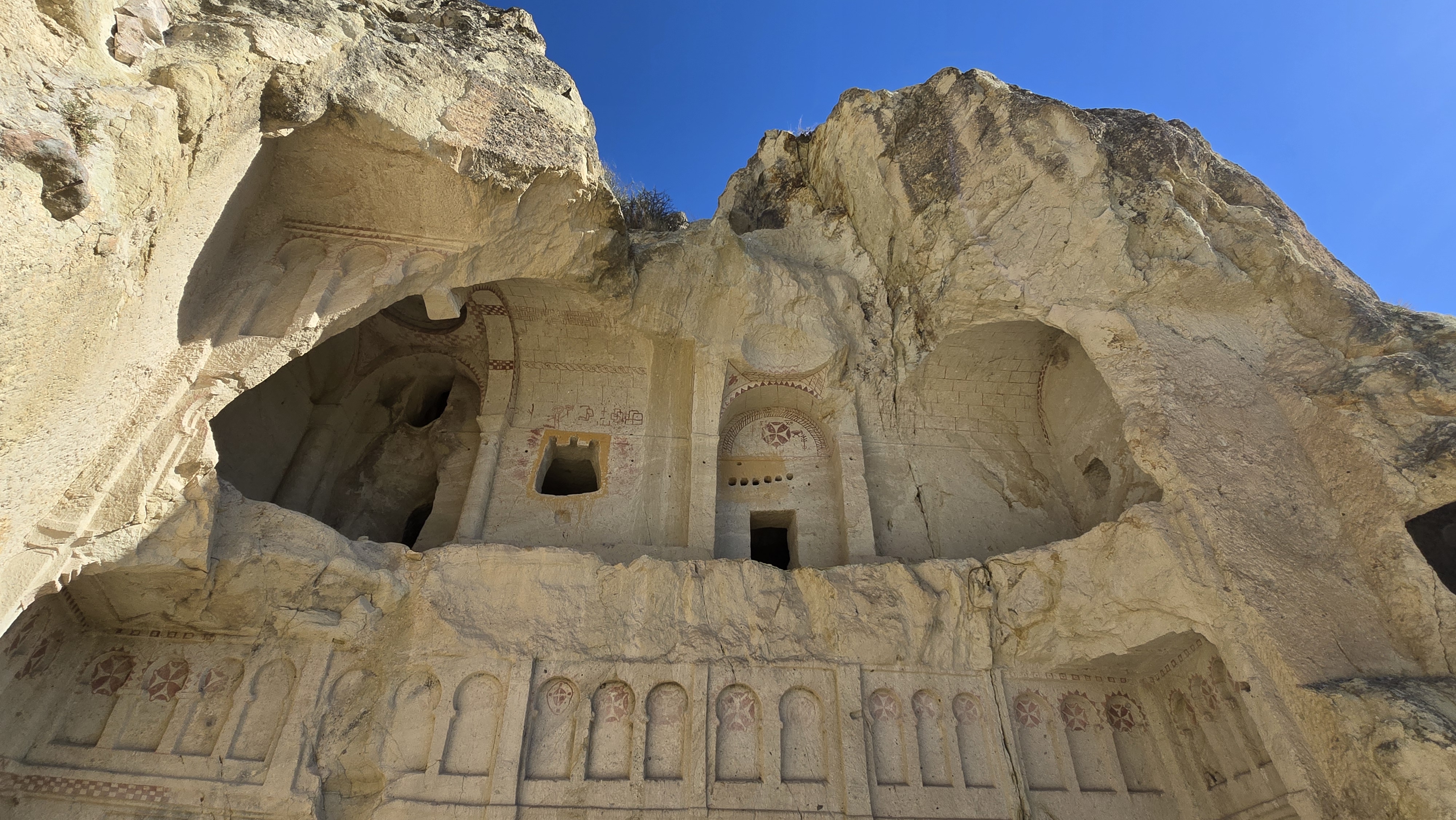
Centuries of rain and wind erosion systematically eroded the soft tuff layers [1]. This natural process generated the world-renowned fairy chimneys [1]. Inhabitants were able to hollow out the interior of these natural rock formations with ease using basic tools [1]. In doing so, they constructed homes, monasteries, and multi-story sanctuaries within the fairy chimneys and cliff faces [1]. The readily excavated rock surfaces provided superior thermal insulation [1]. These spaces served as natural shelters, shielding occupants against both the summer heat and the winter cold [1].
The interior walls of the rock-cut churches and monasteries were adorned with vibrant frescoes [1]. A fresco is the art of painting directly onto wet lime plaster with water-based pigments while the plaster remains fresh and damp [1]. As the plaster cures, the lime binds the pigments within its matrix, integrating the painting inextricably into the wall surface [1]. These buon fresco paintings carry forward the religious realm and artistic sensibilities of the civilizations that inhabited the region over centuries [1]. Various Christian communities arriving in the region in the wake of the Arab incursions also directly influenced the interior decorations and architectural styles of these churches [1].
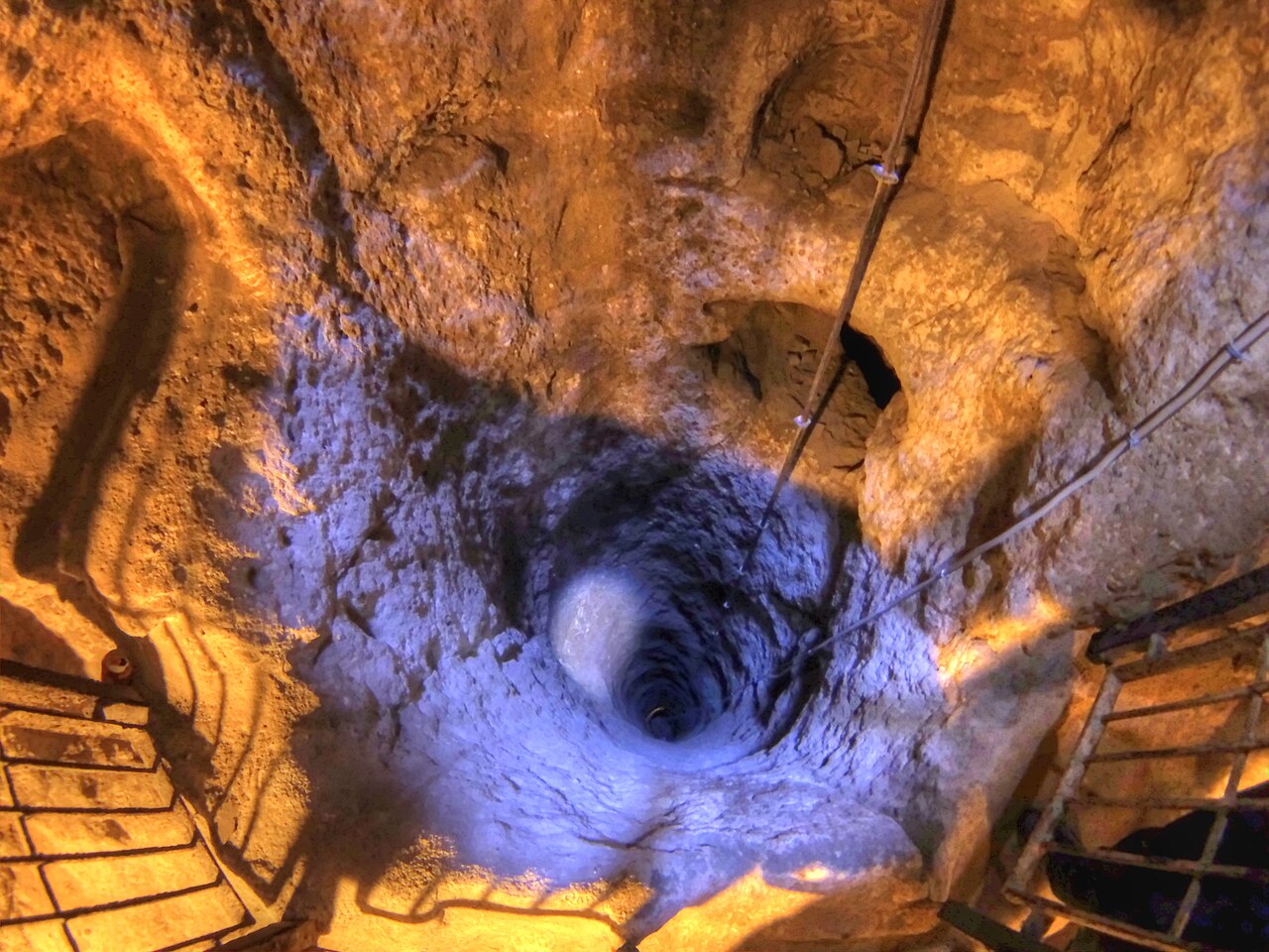
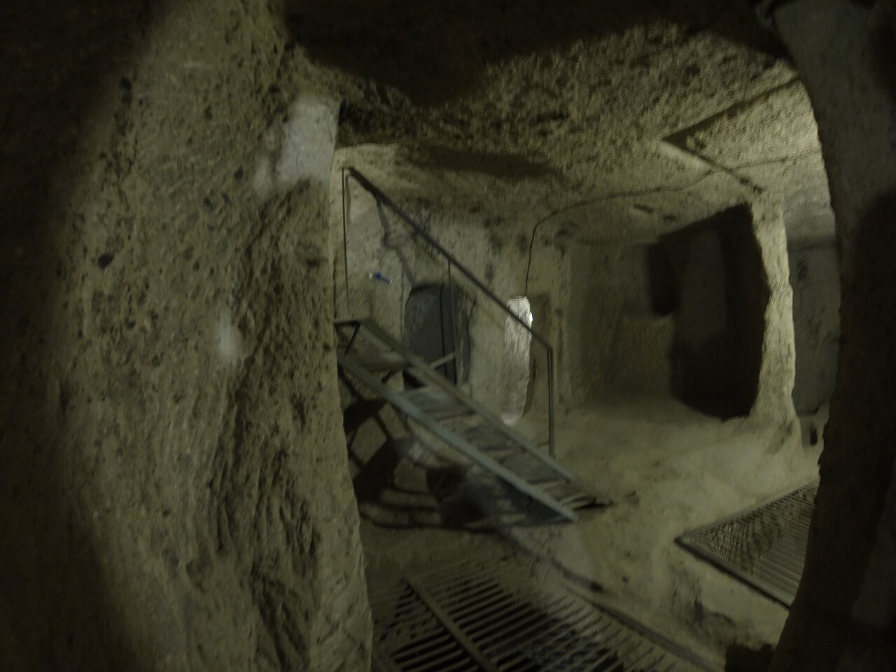
The region’s architectural richness is not confined solely to the surface structures along the valleys [1]. This architectural complexity plunges deep underground as well [1]. Vast subterranean cities such as Derinkuyu and Kaymaklı were excavated for defense during periods of persecution and assault [2]. The term underground city refers to multi-story refuge settlements hollowed out tier upon tier beneath the surface, concealed from exterior view, and capable of sheltering thousands of people [2]. These sanctuary cities consist of complex passages, ventilation shafts, granaries, and residential quarters where inhabitants could remain sequestered for months during emergencies [2].
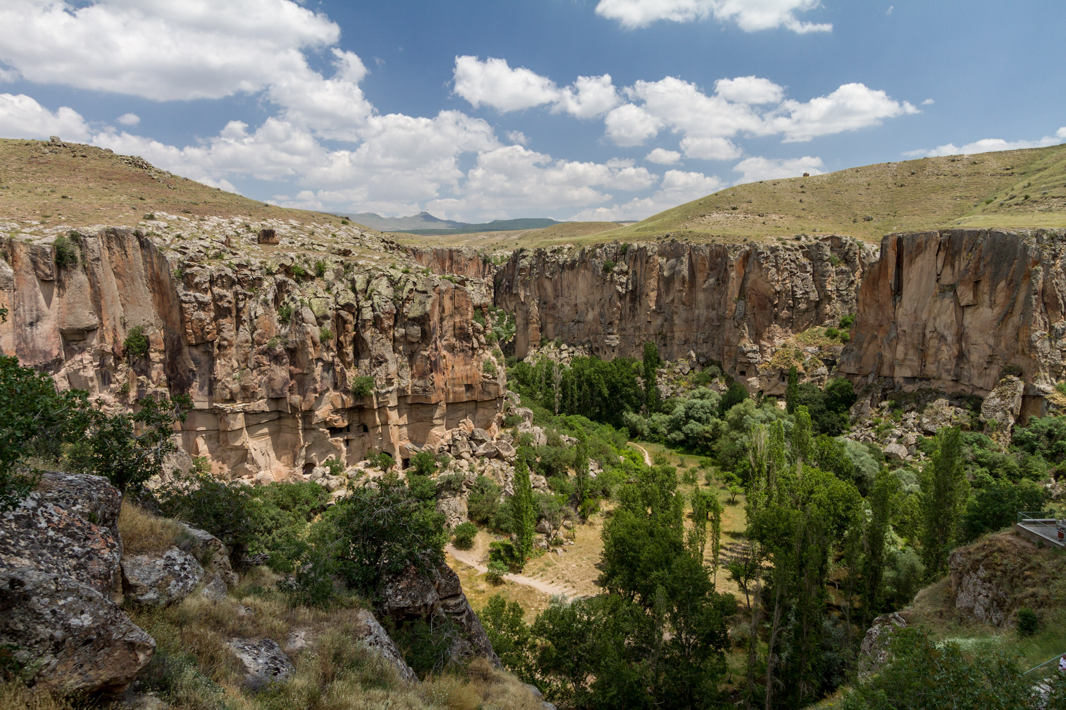
Visually stunning landscapes such as the Kızılçukur Valley, Paşabağı Valley, and Ihlara Valley rank among the region’s most remarkable natural alignments [1] [2]. Thanks to their cultural and natural values, these singular sites are inscribed under UNESCO’s mixed criteria [2]. A UNESCO mixed criterion indicates that a heritage property simultaneously embodies both human-made historical and cultural values and exceptional geological features created by nature [2].
In granting this inscription, UNESCO evaluates properties according to internationally recognized numbered criteria [2]. Göreme and Cappadocia satisfy cultural heritage criteria (i), (iii), and (v) [2]. Criterion (i) denotes a masterpiece of human creative genius [2]. Criterion (iii) signifies bearing a unique testimony to a cultural tradition or civilization that is living or has disappeared [2]. Criterion (v) requires providing an outstanding example of traditional human settlement under difficult natural conditions [2]. For natural heritage, the site satisfies criterion (vii) [2]. This seventh criterion stipulates that the area contain superlative natural beauty and aesthetic importance [2].
Harita
Harita: © OpenStreetMap katkıcıları. Bu yazıda anılan bazı yapılar ve kendi yazıları:
- 1. Durak: Göreme Karanlık Kilise
- 2. Durak: Ihlara Vadisi ve Kaya Kiliseleri: Melendiz Çayı Boyunca Kaya Mimarisi
- 3. Durak: Derinkuyu Yeraltı Şehri: Kapadokya
- 4. Durak: Kaymaklı Yeraltı Şehri: Kapadokya
- 5. Durak: Uçhisar ve Ortahisar Kaya Kaleleri
- 6. Durak: Soğanlı Vadisi ve Kubbeli Kaya Kiliseleri
- 7. Durak: Alâeddin Camii: Selçuklu Dönemi Yapıları
Visiting Notes
Göreme National Park and its surrounding territory stand among Turkey’s most popular cultural and nature routes today [1]. Visitors to the region can explore valley trails [1]. Visitors can likewise closely examine specimens of rock-cut architecture [1]. Rock-cut architecture is an architectural method where structures are created by carving and hollowing out existing natural rock formations directly, rather than building with stone and mortar brought from elsewhere [1]. Furthermore, hot-air balloon flights in the skies above Göreme are among the most preferred recreational and leisure open-air activities [4].
A scientific field study on visitor management within the national park was conducted in 2019 [3]. This research revealed the perspectives of domestic visitors concerning the park [3]. In a survey conducted with 169 domestic visitors touring Göreme, park oversight and safety were identified as primary shortcomings [3]. Additionally, inadequacies were observed in the effective guiding and information provision for visitors within the valley [3].
Intentional or inadvertent damage can occur to the site during tourism activities [3]. This can lead to difficult-to-remedy degradation within the delicate rock structures [3]. Consequently, it is of paramount importance that visitors observe conservation protocols while traversing the soft tuff terrain [3]. Another study conducted with 386 hot-air balloon participants demonstrated that levels of environmental altruism increase pro-environmental behaviors [4]. As visitors’ awareness of environmental responsibility increases, actions aimed at conserving the historic and natural fabric are correspondingly reinforced [4].
Current admission fees for the Göreme Open Air Museum, underground cities, and valleys are not specified in the source texts [1]. Similarly, operational hours, seasonal restrictions, and public transit details are absent from the documentation [1]. Prior to planning a visit, ensure you confirm these practical details directly with the relevant official authorities and up-to-date public notices [1].
References
- [1] “Kapadokya - Vikipedi”, https://tr.wikipedia.org/wiki/Kapadokya
- [2] “Cappadocia - Wikipedia”, https://en.wikipedia.org/wiki/Cappadocia
- [3] “Göreme Milli Parkı ve Kapadokya Kayalık Bölgeleri’ndeki Ziyaretçi Etki Yönetimi Uygulamalarının Yerli Ziyaretçiler Tarafından Değerlendirilmesi — Derya TOKSÖZ, ”, https://dergipark.org.tr/tr/download/article-file/2989120
- [4] “Çevre Endişesi, Çevresel Fedakârlık, Normlar ve Yer Tutumunun Çevre Dostu Davranışa Etkisi: Kapadokya/Göreme Milli Parkı Örneği — Lütfi Atay, Yasin Soylu, Sinan”, https://dergipark.org.tr/tr/download/article-file/874136
Stops along the Route (7)
The Dark Church of Göreme: Byzantine Rock Carvings in Cappadocia
Ihlara Valley and Rock Churches: Rock Architecture Along the Melendiz River
Derinkuyu Underground City: A Multi-Level Rock-Carved Settlement in Cappadocia
Kaymakli Underground City: Cappadocia's Multi-Level Refuge
Rock Castles of Uchisar and Ortahisar
Soğanlı Valley and the Dome-Shaped Rock Churches
Alâeddin Mosque: Structures of the Seljuk Period
This article is compiled from scholarly monographs and official architectural inventories. Please verify site access conditions, visiting hours, and ongoing conservation status via official heritage authorities prior to visiting.